
Your phone can locate its position without relying on a mobile signal, Wi-Fi, or data plan. The GPS receiver understands satellite signals directly, which has nothing to do with your network. What doesn’t work offline is the map itself, because those photos are downloaded from a server as you scroll. Download the map beforehand, and the whole software keeps working. The apps that do this correctly are Organic Maps and OsmAnd, for most people, with Google Maps offline a weaker option than most users assume.
GPS Can Locate You Without a Mobile Signal
GPS positioning requires no mobile data, and only the map tiles do. Google Maps offline provides driving directions only, with no walking or cycling paths. Organic Maps is free, open source, and downloads whole countries in a few hundred megabytes. OsmAnd adds contour lines and hillshading, which are important for anything off-road. Airplane mode with location left on helps reduce battery usage and saves a good amount of battery because the radio stops hunting for signals. Download before you travel, as doing it only when you need it assumes a connection you may not have.
Since GPS is a receiver, not a connection, your phone understands timed signals delivered by satellites and calculates its own position from the distance between them. Nothing is sent back, and no network is needed here. The confusion arrives because of what happens next. The location of our phone is a pair of coordinates, and coordinates have no meaning until they are drawn on a map. That map is the reason your phone normally streams from a server.
One feature does slow down without a connection. Assisted GPS requires network data to tell your phone roughly about its location and which satellites to expect, which speeds up the first fix to a few seconds. Without this, a cold start can take 30 to 60 seconds in the open, and longer under tree cover or in a valley. The sensible fix is to switch on the app and let it figure out your location before you need it, instead of just pulling your phone out at a junction and waiting.
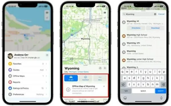
Google Maps works offline, but only under limits that catch people out. Google Maps allows you to download a specific area for offline use, and the maps reload automatically when you reconnect. However, the limitations are more important than the feature. Offline maps include cars, but walking, cycling, and transit directions all need a connection. You install a photo of a specific rectangle rather than a country, and large regions get rejected or split. Google’s primary map has roads and important paths, not the random footpath detail that mapping projects have, and multiple place lookups and all checks need data. For a city break where you primarily only have to locate a restaurant and drive to the hotel, it is sufficient, but for anything above paved roads, this is inadequate.
Three factors are worth understanding for most people, and the right choice depends on whether you are navigating roads or terrain. Organic Maps is a free app using OpenStreetMap with walking, cycling, and driving offline routing, no contours, and is best for simple, fast, and privacy-friendly navigation. OsmAnd offers a free tier with paid unlocks using OpenStreetMap, supports walking, cycling, and driving offline routing, includes optional contour lines and terrain add-on downloads, and is best for hiking and off-road use.
What Google Maps Can and Cannot Do Offline
Google Maps is free, uses Google map data, offers driving-only offline routing without contours, and is best for cities and road trips. Komoot requires region purchases, uses OpenStreetMap, offers offline routing and terrain, and is best for route planning in Europe. Gaia GPS uses a subscription model, provides multiple topo layers, routing, and terrain, and is best for the backcountry, being strongest in North America.
Organic Maps is the most obvious recommendation. It is open source, carries no ads or tracking, downloads by country or region, and manages offline search and turn-by-turn walking directions without a connection. OsmAnd is the perfect fit to choose if terrain is important. Its contour line and hillshade packages are completely different downloads that render elevation properly, which alters a flat line on a screen into a route you can judge. The free tier restricts how many map regions you can download, and the paid is a one-off rather than a subscription. Both extract from OpenStreetMap, which is a collaborative mapping software with a greater footpath coverage than commercial maps in majority areas of the world.
You actually need offline maps more consistently than most people expect, and in four situations specifically. When travelling abroad without roaming, downloading a country map previous to your flight helps reduce any dependence on finding a working SIM or Wi-Fi at the other end and prevents roaming charges entirely. Underground and in dense cities, metro systems and some built-up areas diminish data while GPS recovers faster on the surface, making an offline map offer an efficient display throughout.
In rural driving, coverage inconsistency on stretched routes is pretty obvious in most countries, and a downloaded region makes the difference between navigation that does not stop mid-journey. Finally, for multi-day hikes where coverage runs out before the trail does, mobile data dies down well before you reach anywhere slightly remote. On popular treks like Everest Base Camp in Nepal, Ncell and Nepal Telecom signal cannot be treated as trustworthy above Namche Bazaar at 3,440 meters, and the paid Wi-Fi network which includes the higher lodges sells data by the gigabyte at around NPR 2,000 for a 10 GB card, making downloading the region map beforehand a free solution that covers the entire route.
This last situation is where offline maps stop being a way to avoid hassles and start being a genuinely useful tool.
Mobile coverage still does not reach everywhere, and the information regarding where it reaches is far more predictable than it looks. Coverage depends on roads, because towers need access for construction, maintenance, and power. That produces huge differences between places that look similar on a map. Nepal’s two main trekking regions demonstrate it well. A road now reaches Manang at 3,519 meters and continues toward Muktinath, so mobile coverage on the Annapurna Circuit holds at heights where the Everest region, which has no road at all, has none.
Why Offline Maps Matter in Places Like the Scottish Highlands
The same logic makes sense even in the Scottish Highlands, the Pyrenees, and most of the American West. The difference in the distance from a road indicates coverage better than remoteness or altitude does. Satellite texting has started transforming this at the margins. Latest iPhone and Android models support emergency satellite messaging in supported countries, and dedicated equipment such as the Garmin inReach offers two-way messaging on a subscription. Neither provides map data, so offline maps remain the viable answer for navigation.
Offline maps require a lot less storage than most people think. OpenStreetMap-based apps include vector data instead of storing photos, so a whole country is mostly tens to a few hundred megabytes. For instance, a small vector country map takes 50 to 200 MB, a large country vector map takes 500 MB to 2 GB, contour lines for a region in OsmAnd take 100 to 500 MB, a hillshade overlay for a region takes 100 MB to 1 GB, and a Google Maps offline area takes 200 MB to 1.5 GB per area.
The vector method is the reason why these apps expand so well. Rather than collecting a picture of a map at every zoom level, the app stores the underlying data and illustrates the map on your device, which is why zooming works efficiently offline. Download over Wi-Fi, and determine whether those files are actually on the device instead of just being queued, which is the separate most obvious failure.
To stop offline maps from draining the battery, put the phone in airplane mode and keep the location services on. This is the most significant single saving available, and a lot of people do the opposite. With no signal, the radio builds transmission power and scans repeatedly looking for a tower, which requires far more power than idle. Airplane mode stops that hunting, while GPS is unaffected because the receiver only listens.